


La Brigue -Notre Dame des Fontaines

GeorgesV.
User
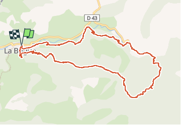

Length
14.2 km

Max alt
1449 m

Uphill gradient
824 m
Km-Effort
25 km

Min alt
770 m

Downhill gradient
822 m
Boucle
Yes
Creation date :
2024-05-17 06:30:23.0
Updated on :
2024-05-17 14:41:21.666

FREE GPS app for hiking
 SityTrail
IGN / Geographical institutes
SityTrail Plus
The world is yours!
About
Trail of 14.2 km to be discovered at Provence-Alpes-Côte d'Azur, Maritime Alps, La Brigue. This trail is proposed by GeorgesV..
Positioning
Country:
France
Region :
Provence-Alpes-Côte d'Azur
Department/Province :
Maritime Alps
Municipality :
La Brigue
Location:
Unknown
Start:(Dec)
Start:(UTM)
389205 ; 4879841 (32T) N.
Comments